
- Start >
- Rivers >
- Waterlevel >
- Bayern >
- Untersteinach >
- Chart of total period

Chart of total period Untersteinach / Warme Steinach
Waterlevel from 01.11.1963 to 26.04.2024
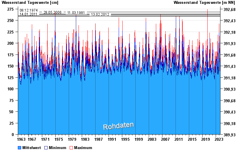
- 08.12.1974 Wasserstand: 268 cm
- 28.05.2006 Wasserstand: 264 cm
- 11.03.1981 Wasserstand: 263 cm
- 14.01.2011 Wasserstand: 260 cm
- 13.02.2012 Wasserstand: 259 cm
| Date | Mean value [cm] | Maximum [cm] | Minimum [cm] |
|---|---|---|---|
| 26.04.2024 | 142 | 142 | 142 |
| 25.04.2024 | 142 | 144 | 141 |
| 24.04.2024 | 141 | 142 | 140 |
| 23.04.2024 | 143 | 144 | 141 |
| 22.04.2024 | 146 | 150 | 144 |
| 21.04.2024 | 151 | 163 | 145 |
| 20.04.2024 | 149 | 154 | 145 |
© Bayerisches Landesamt für Umwelt 2024