
- Start >
- Rivers >
- Waterlevel >
- Bayern >
- Untersteinach >
- Chart of total period

Chart of total period Untersteinach / Warme Steinach
Waterlevel from 01.11.1963 to 23.04.2024
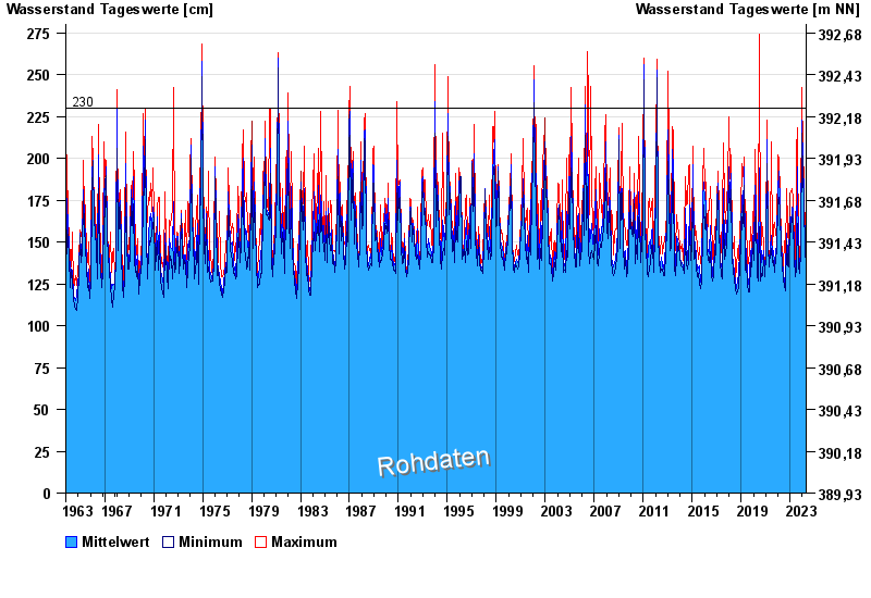
- 230 cm: Verbindungsweg Untersteinach - Döhlau: Überflutung.
- 230 cm: Untersteinach: Linksseitige Ausuferung oberhalb der Pegelstelle.
| Date | Mean value [cm] | Maximum [cm] | Minimum [cm] |
|---|---|---|---|
| 23.04.2024 | 143 | 144 | 141 |
| 22.04.2024 | 146 | 150 | 144 |
| 21.04.2024 | 151 | 163 | 145 |
| 20.04.2024 | 149 | 154 | 145 |
| 19.04.2024 | 136 | 145 | 132 |
| 18.04.2024 | 133 | 134 | 132 |
| 17.04.2024 | 135 | 137 | 133 |
© Bayerisches Landesamt für Umwelt 2024