
- Start >
- Rivers >
- Waterlevel >
- Naab - Regen >
- Hocha Perlseeabfluss >
- Chart of year

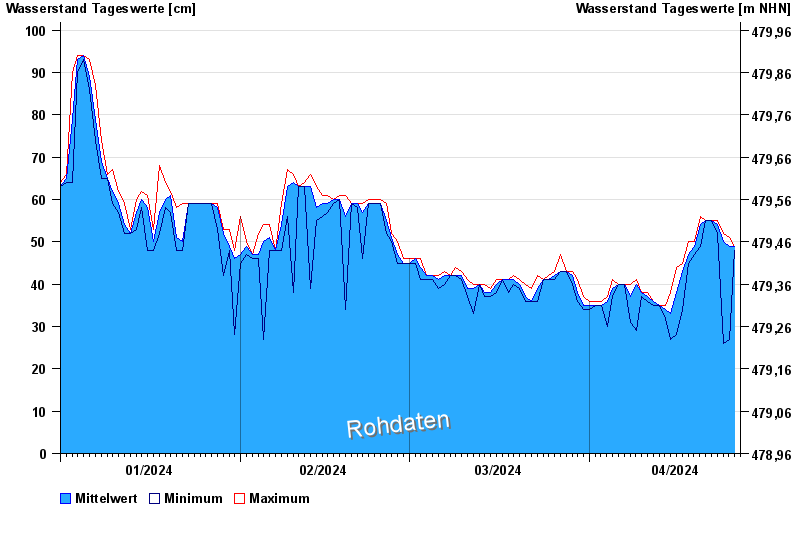
Chart of year Hocha Perlseeabfluss / Schwarzach
Waterlevel from 01.01.2024 to 26.04.2024
- 02.01.1987 Wasserstand: 144 cm
- 12.03.1981 Wasserstand: 132 cm
- 26.03.1988 Wasserstand: 124 cm
- 27.04.1970 Wasserstand: 114 cm
- 29.01.2002 Wasserstand: 111 cm
| Date | Mean value [cm] | Maximum [cm] | Minimum [cm] |
|---|---|---|---|
| 26.04.2024 | 49 | 49 | 48 |
| 25.04.2024 | 49 | 51 | 27 |
| 24.04.2024 | 50 | 52 | 26 |
| 23.04.2024 | 54 | 55 | 52 |
| 22.04.2024 | 55 | 55 | 55 |
| 21.04.2024 | 55 | 55 | 55 |
| 20.04.2024 | 54 | 56 | 49 |
© Bayerisches Landesamt für Umwelt 2024