
- Start >
- Rivers >
- Waterlevel >
- Bayern >
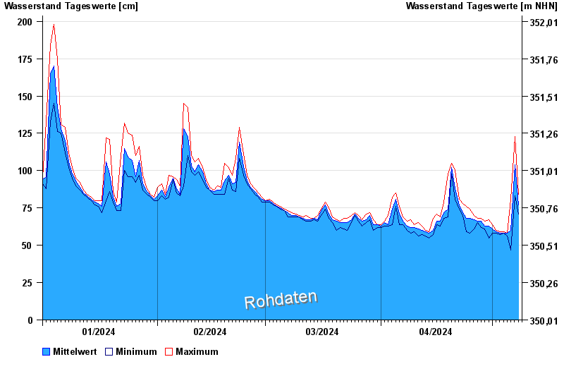
- Schrottenbaummühle >
- Chart of year

Chart of year Schrottenbaummühle / Ilz
Waterlevel from 01.01.2024 to 08.05.2024
- 21.12.1993 Wasserstand: 328 cm
- 16.03.2019 Wasserstand: 296 cm
- 13.08.2002 Wasserstand: 288 cm
- 12.03.1981 Wasserstand: 267 cm
- 01.03.2008 Wasserstand: 261 cm
| Date | Mean value [cm] | Maximum [cm] | Minimum [cm] |
|---|---|---|---|
| 08.05.2024 | 82 | 84 | 79 |
| 07.05.2024 | 104 | 123 | 83 |
| 06.05.2024 | 60 | 81 | 47 |
| 05.05.2024 | 58 | 58 | 56 |
| 04.05.2024 | 58 | 59 | 58 |
| 03.05.2024 | 58 | 59 | 57 |
| 02.05.2024 | 59 | 60 | 58 |
© Bayerisches Landesamt für Umwelt 2024