
- Start >
- Rivers >
- Waterlevel >
- Bayern >
- Gampelmühle >
- Chart of year

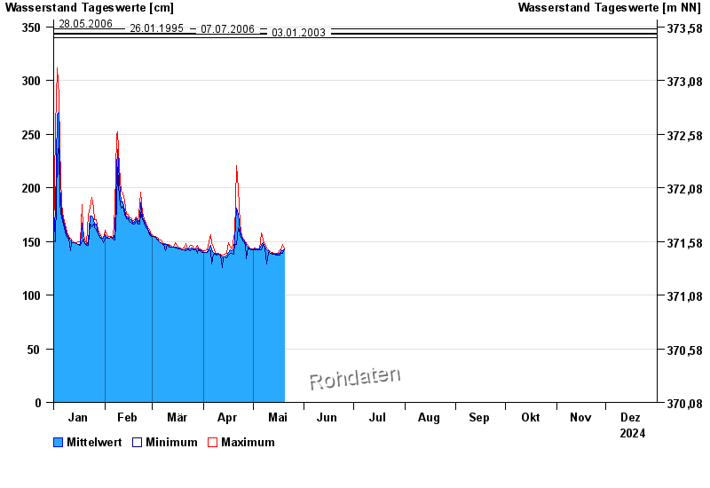
Chart of year Gampelmühle / Ölschnitz
Waterlevel from 01.01.2024 to 31.12.2024
- 06.06.1984 Wasserstand: 357 cm
- 28.05.2006 Wasserstand: 348 cm
- 26.01.1995 Wasserstand: 344 cm
- 07.07.2006 Wasserstand: 343 cm
- 03.01.2003 Wasserstand: 340 cm
| Date | Mean value [cm] | Maximum [cm] | Minimum [cm] |
|---|---|---|---|
| 07.06.2024 | 146 | 147 | 146 |
| 06.06.2024 | 148 | 149 | 146 |
| 05.06.2024 | 150 | 152 | 149 |
| 04.06.2024 | 155 | 159 | 152 |
| 03.06.2024 | 165 | 177 | 159 |
| 02.06.2024 | 185 | 198 | 162 |
| 01.06.2024 | 155 | 167 | 150 |
© Bayerisches Landesamt für Umwelt 2024