
- Start >
- Rivers >
- Waterlevel >
- Bayern >
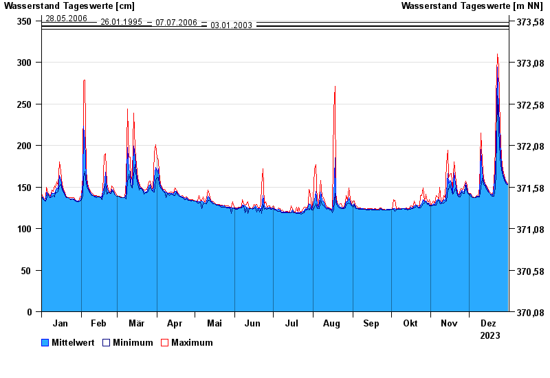
- Gampelmühle >
- Chart of year

Chart of year Gampelmühle / Ölschnitz
Waterlevel from 01.01.2023 to 31.12.2023
- 15.06.2020 Wasserstand: 361 cm
- 06.06.1984 Wasserstand: 357 cm
- 28.05.2006 Wasserstand: 348 cm
- 26.01.1995 Wasserstand: 344 cm
- 07.07.2006 Wasserstand: 343 cm
| Date | Mean value [cm] | Maximum [cm] | Minimum [cm] |
|---|---|---|---|
| 31.12.2023 | 154 | 155 | 153 |
| 30.12.2023 | 155 | 156 | 154 |
| 29.12.2023 | 158 | 160 | 156 |
| 28.12.2023 | 161 | 164 | 159 |
| 27.12.2023 | 166 | 170 | 164 |
| 26.12.2023 | 177 | 185 | 170 |
| 25.12.2023 | 204 | 222 | 185 |
© Bayerisches Landesamt für Umwelt 2025