
- Start >
- Groundwater >
- Waterlevel of upper layer >
- Unterer Main >
- OBERTHULBA B 212 >
- Chart of total period

Chart of total period OBERTHULBA B 212
Groundwater levels of the total period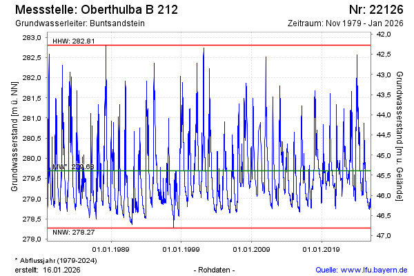
Groundwater level [m above sealevel]: 280.62
Distance to surface [m]: 44.39
Last value from 07.05.2024 10:00
Ground level [m above sealevel]: 325.01
| Date | Groundwater level [m above sealevel] |
|---|---|
| 07.05.2024 | 280.60 |
| 06.05.2024 | 280.54 |
| 05.05.2024 | 280.50 |
| 04.05.2024 | 280.49 |
| 03.05.2024 | 280.47 |
| 02.05.2024 | 280.46 |
| 01.05.2024 | 280.47 |
| 30.04.2024 | 280.47 |
© Bayerisches Landesamt für Umwelt 2024