
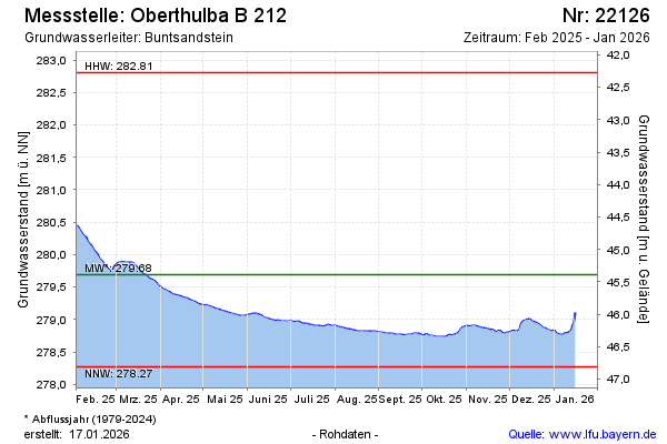
Current data Oberthulba B 212
Groundwater level [m above sealevel]: 278.65
Distance to surface [m]: 46.43
Last value from 13.07.2026 10:00
Ground level [m above sealevel]: 325.08
| Date | Groundwater level [m above sealevel] |
|---|---|
| 13.07.2026 | 278.67 |
| 12.07.2026 | 278.67 |
| 11.07.2026 | 278.67 |
| 10.07.2026 | 278.68 |
| 09.07.2026 | 278.69 |
| 08.07.2026 | 278.68 |
| 07.07.2026 | 278.68 |
| 06.07.2026 | 278.68 |