
- Start >
- Groundwater >
- Waterlevel of upper layer >
- Unterer Main >
- Oberthulba B 212 >
- Chart of total period

Chart of total period Oberthulba B 212
Groundwater levels of the total period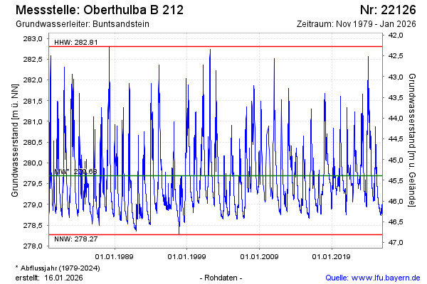
Groundwater level [m above sealevel]: 279.18
Distance to surface [m]: 45.90
Last value from 13.04.2026 10:00
Ground level [m above sealevel]: 325.08
| Date | Groundwater level [m above sealevel] |
|---|---|
| 13.04.2026 | 279.19 |
| 12.04.2026 | 279.20 |
| 11.04.2026 | 279.21 |
| 10.04.2026 | 279.23 |
| 09.04.2026 | 279.24 |
| 08.04.2026 | 279.25 |
| 07.04.2026 | 279.27 |
| 06.04.2026 | 279.29 |
© Bayerisches Landesamt für Umwelt 2026