
- Start >
- Groundwater >
- Waterlevel of upper layer >
- Unterer Main >
- Obersinn >
- Chart of total period

Chart of total period Obersinn
Groundwater levels of the total period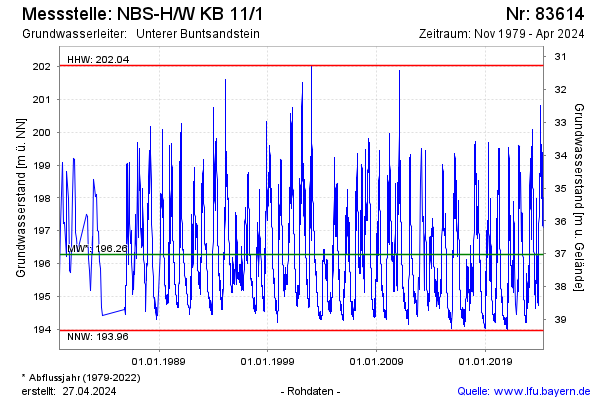
Groundwater level [m above sealevel]: 197.79
Distance to surface [m]: 35.51
Last value from 03.05.2024 09:58
Ground level [m above sealevel]: 233.30
| Date | Groundwater level [m above sealevel] |
|---|---|
| 03.05.2024 | 197.79 |
| 02.05.2024 | 197.80 |
| 01.05.2024 | 197.83 |
| 30.04.2024 | 197.88 |
| 29.04.2024 | 197.93 |
| 28.04.2024 | 197.97 |
| 27.04.2024 | 198.00 |
| 26.04.2024 | 198.01 |
© Bayerisches Landesamt für Umwelt 2024