
- Start >
- Groundwater >
- Waterlevel of upper layer >
- Unterer Main >
- Obersinn >
- Chart of total period

Chart of total period Obersinn
Groundwater levels of the total period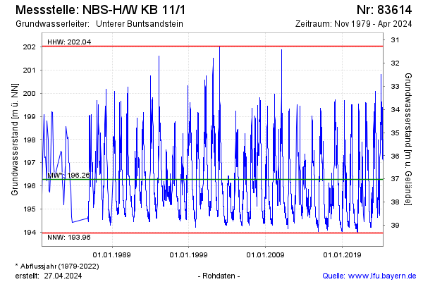
Groundwater level [m above sealevel]: 195.78
Distance to surface [m]: 37.52
Last value from 11.04.2026 10:00
Ground level [m above sealevel]: 233.30
| Date | Groundwater level [m above sealevel] |
|---|---|
| 11.04.2026 | 195.78 |
| 10.04.2026 | 195.80 |
| 09.04.2026 | 195.84 |
| 08.04.2026 | 195.88 |
| 07.04.2026 | 195.93 |
| 06.04.2026 | 195.97 |
| 05.04.2026 | 196.01 |
| 04.04.2026 | 196.05 |
© Bayerisches Landesamt für Umwelt 2026