
- Start >
- Groundwater >
- Waterlevel of deep layer >
- Bayern >
- Lohhof GS2 >
- Chart of total period

Chart of total period Lohhof GS2
Groundwater levels of the total period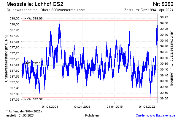
Groundwater level [m above sealevel]: 537.70
Distance to surface [m]: 39.31
Last value from 20.05.2026 09:00
Ground level [m above sealevel]: 577.01
| Date | Groundwater level [m above sealevel] |
|---|---|
| 20.05.2026 | 537.71 |
| 19.05.2026 | 537.72 |
| 18.05.2026 | 537.74 |
| 17.05.2026 | 537.74 |
| 16.05.2026 | 537.76 |
| 15.05.2026 | 537.80 |
| 14.05.2026 | 537.80 |
| 13.05.2026 | 537.78 |
© Bayerisches Landesamt für Umwelt 2026