
- Start >
- Groundwater >
- Waterlevel of deep layer >
- Bayern >
- Lohhof GS2 >
- Year chart of precipitation

Year chart of precipitation Lohhof GS2
Groundwater levels of the last 12 months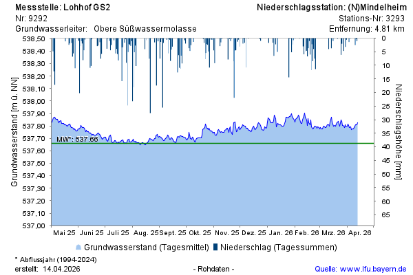
Groundwater level [m above sealevel]: 537,76
Distance to surface [m]: 39,25
Last value from 03.05.2026 09:00
Ground level [m above sealevel]: 577.01
© Bayerisches Landesamt für Umwelt 2026