
- Start >
- Groundwater >
- Waterlevel of upper layer >
- Bayern >
- Hammer Gw2 (BK4) >
- Master data

Master data Hammer Gw2 (BK4)
Site number: 21331
Measuring point system: Staatliches Sondernetz
Community: Fischbachau
District: Miesbach
Operator:  Wasserwirtschaftsamt Rosenheim
Aquifer:
Measurement site depth under ground: 8.00 m
Ground level: 755.24 m above sealevel
Easting: 720747 (ETRS89 / UTM Zone 32N)
Northing: 5287446
Observation period: 04.07.2017 to 12.02.2024
Maximum waterlevel (HHW): 754.75 m above sealevel
Mean waterlevel (MW): 753.89 m above sealevel
Minimum waterlevel (NNW): 753.73 m above sealevel
Mean Highest Groundwater Level (MHGW): 754.50 m above sealevel (Period: 01.11.2016 - 01.11.2024)
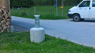
Picture of the measurement site
Location of the station Hammer Gw2 (BK4)
| Measurement site | Category |
|---|---|
 Rosenheim o.d. Mangfallmündung Rosenheim o.d. Mangfallmündung | Rivers: Runoff, Waterlevel, Water temperature, Water temperature, Suspended sediment |
| Bleyerbrücke | Rivers: Runoff, Waterlevel |
| Bad Trißl | Rivers: Runoff, Waterlevel |
| Mühlhausen | Rivers: Runoff, Waterlevel |