
- Start >
- Groundwater >
- Waterlevel of upper layer >
- Bayern >
- Hammer Gw2 (BK4) >
- Current data

Current data Hammer Gw2 (BK4)
Groundwater levels of the last 12 months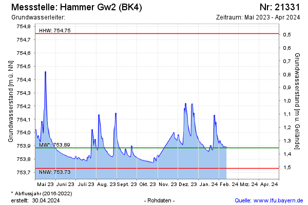
Groundwater level [m above sealevel]: 753.91
Distance to surface [m]: 1.33
Last value from 02.03.2026 11:37
Ground level [m above sealevel]: 755.24
| Date | Groundwater level [m above sealevel] |
|---|---|
| 02.03.2026 | 753.91 |
| 01.03.2026 | 753.92 |
| 28.02.2026 | 753.94 |
| 27.02.2026 | 753.98 |
| 26.02.2026 | 754.01 |
| 25.02.2026 | 754.14 |
| 24.02.2026 | 754.41 |
| 23.02.2026 | 753.96 |
© Bayerisches Landesamt für Umwelt 2026