
- Start >
- Rivers >
- Waterlevel >
- Untere Donau >
- Straubing >
- Chart of year

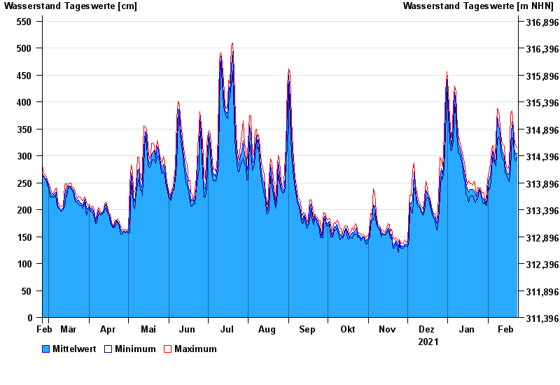
Chart of year Straubing / Donau
Waterlevel from 24.02.2021 to 23.02.2022
- 05.06.2013 Wasserstand: 795 cm
- 14.08.2002 Wasserstand: 749 cm
- 28.03.1988 Wasserstand: 702 cm
- 16.01.2011 Wasserstand: 699 cm
- 25.05.1999 Wasserstand: 686 cm
| Date | Mean value [cm] | Maximum [cm] | Minimum [cm] |
|---|---|---|---|
| 23.02.2022 | 305 | 314 | 298 |
| 22.02.2022 | 303 | 319 | 290 |
| 21.02.2022 | 314 | 333 | 298 |
| 20.02.2022 | 343 | 354 | 333 |
| 19.02.2022 | 363 | 383 | 334 |
| 18.02.2022 | 319 | 378 | 277 |
| 17.02.2022 | 266 | 285 | 252 |
© Bayerisches Landesamt für Umwelt 2024