
- Start >
- Rivers >
- Waterlevel >
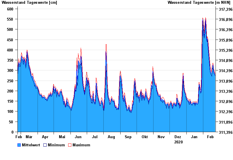
- Untere Donau >
- Straubing >
- Chart of year

Chart of year Straubing / Donau
Waterlevel from 24.02.2020 to 23.02.2021
- 05.06.2013 Wasserstand: 795 cm
- 14.08.2002 Wasserstand: 749 cm
- 28.03.1988 Wasserstand: 702 cm
- 16.01.2011 Wasserstand: 699 cm
- 25.05.1999 Wasserstand: 686 cm
| Date | Mean value [cm] | Maximum [cm] | Minimum [cm] |
|---|---|---|---|
| 23.02.2021 | 278 | 283 | 273 |
| 22.02.2021 | 287 | 293 | 280 |
| 21.02.2021 | 295 | 303 | 283 |
| 20.02.2021 | 308 | 313 | 300 |
| 19.02.2021 | 327 | 336 | 309 |
| 18.02.2021 | 319 | 332 | 313 |
| 17.02.2021 | 290 | 313 | 271 |
© Bayerisches Landesamt für Umwelt 2024