
- Start >
- Rivers >
- Waterlevel >
- Untere Donau >
- Plattling >
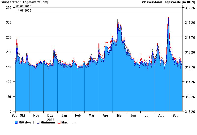
- Chart of year

Chart of year Plattling / Isar
Waterlevel from 30.09.2022 to 29.09.2023
- 04.06.2013 Wasserstand: 400 cm
- 24.05.1999 Wasserstand: 378 cm
- 25.08.2005 Wasserstand: 374 cm
- 04.06.2010 Wasserstand: 349 cm
- 14.08.2002 Wasserstand: 335 cm
| Date | Mean value [cm] | Maximum [cm] | Minimum [cm] |
|---|---|---|---|
| 29.09.2023 | 161 | 167 | 155 |
| 28.09.2023 | 164 | 169 | 160 |
| 27.09.2023 | 155 | 165 | 141 |
| 26.09.2023 | 158 | 167 | 143 |
| 25.09.2023 | 173 | 182 | 158 |
| 24.09.2023 | 176 | 181 | 171 |
| 23.09.2023 | 171 | 179 | 161 |
© Bayerisches Landesamt für Umwelt 2024