
- Start >
- Rivers >
- Waterlevel >
- Untere Donau >
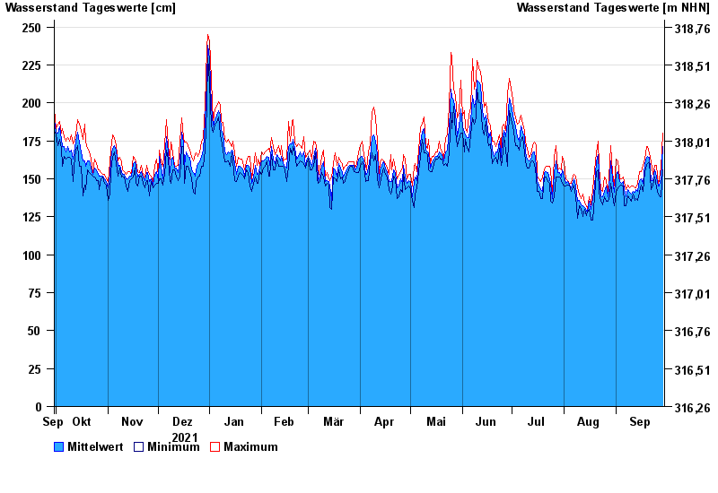
- Plattling >
- Chart of year

Chart of year Plattling / Isar
Waterlevel from 30.09.2021 to 29.09.2022
- 04.06.2013 Wasserstand: 400 cm
- 24.05.1999 Wasserstand: 378 cm
- 25.08.2005 Wasserstand: 374 cm
- 04.06.2010 Wasserstand: 349 cm
- 14.08.2002 Wasserstand: 335 cm
| Date | Mean value [cm] | Maximum [cm] | Minimum [cm] |
|---|---|---|---|
| 29.09.2022 | 171 | 180 | 156 |
| 28.09.2022 | 150 | 157 | 138 |
| 27.09.2022 | 145 | 150 | 139 |
| 26.09.2022 | 145 | 146 | 140 |
| 25.09.2022 | 151 | 159 | 144 |
| 24.09.2022 | 156 | 159 | 151 |
| 23.09.2022 | 149 | 153 | 146 |
© Bayerisches Landesamt für Umwelt 2024