
- Start >
- Rivers >
- Waterlevel >
- Untere Donau >
- Passau Marienbrücke >
- Chart of year

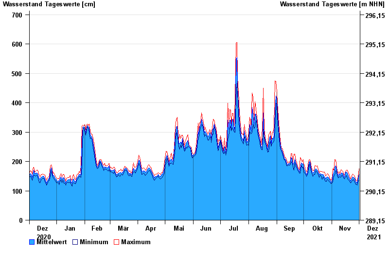
Chart of year Passau Marienbrücke / Inn
Waterlevel from 02.12.2020 to 01.12.2021
- 03.06.2013 Wasserstand: 1028 cm
- 13.08.2002 Wasserstand: 843 cm
- 21.07.1981 Wasserstand: 736 cm
- 03.08.1991 Wasserstand: 720 cm
- 08.08.1985 Wasserstand: 716 cm
| Date | Mean value [cm] | Maximum [cm] | Minimum [cm] |
|---|---|---|---|
| 01.12.2021 | 156 | 175 | 135 |
| 30.11.2021 | 142 | 148 | 134 |
| 29.11.2021 | 128 | 136 | 119 |
| 28.11.2021 | 129 | 134 | 123 |
| 27.11.2021 | 130 | 135 | 123 |
| 26.11.2021 | 142 | 151 | 129 |
| 25.11.2021 | 146 | 153 | 138 |
© Bayerisches Landesamt für Umwelt 2024