
- Start >
- Rivers >
- Waterlevel >
- Untere Donau >
- Landau >
- Chart of year

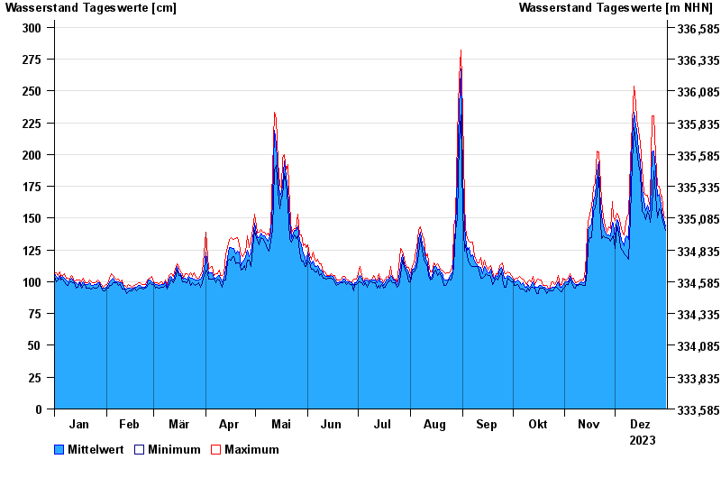
Chart of year Landau / Isar
Waterlevel from 01.01.2023 to 31.12.2023
- 04.06.2013 Wasserstand: 495 cm
- 19.06.1979 Wasserstand: 485 cm
- 24.05.1999 Wasserstand: 467 cm
- 25.08.2005 Wasserstand: 462 cm
- 22.07.1981 Wasserstand: 411 cm
| Date | Mean value [cm] | Maximum [cm] | Minimum [cm] |
|---|---|---|---|
| 31.12.2023 | 144 | 150 | 140 |
| 30.12.2023 | 149 | 152 | 145 |
| 29.12.2023 | 155 | 167 | 150 |
| 28.12.2023 | 160 | 167 | 156 |
| 27.12.2023 | 169 | 175 | 157 |
| 26.12.2023 | 167 | 176 | 150 |
| 25.12.2023 | 188 | 199 | 168 |
© Bayerisches Landesamt für Umwelt 2025