
- Start >
- Rivers >
- Waterlevel >
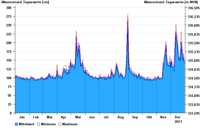
- Untere Donau >
- Landau >
- Chart of year

Chart of year Landau / Isar
Waterlevel from 01.01.2023 to 31.12.2023
- 380 cm: Landau: Überflutung der Vorländer.
- 460 cm: Landau: Aufruf der Deichwehren.
- 600 cm: Landau: Überflutung der Deiche an den Tiefstellen.
| Date | Mean value [cm] | Maximum [cm] | Minimum [cm] |
|---|---|---|---|
| 31.12.2023 | 144 | 150 | 140 |
| 30.12.2023 | 149 | 152 | 145 |
| 29.12.2023 | 155 | 167 | 150 |
| 28.12.2023 | 160 | 167 | 156 |
| 27.12.2023 | 169 | 175 | 157 |
| 26.12.2023 | 167 | 176 | 150 |
| 25.12.2023 | 188 | 199 | 168 |
© Bayerisches Landesamt für Umwelt 2024