
- Start >
- Rivers >
- Waterlevel >
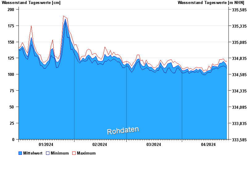
- Untere Donau >
- Landau >
- Chart of year

Chart of year Landau / Isar
Waterlevel from 01.01.2024 to 26.04.2024
- 380 cm: Landau: Überflutung der Vorländer.
- 460 cm: Landau: Aufruf der Deichwehren.
- 600 cm: Landau: Überflutung der Deiche an den Tiefstellen.
| Date | Mean value [cm] | Maximum [cm] | Minimum [cm] |
|---|---|---|---|
| 26.04.2024 | 113 | 120 | 109 |
| 25.04.2024 | 117 | 120 | 112 |
| 24.04.2024 | 120 | 124 | 113 |
| 23.04.2024 | 117 | 123 | 112 |
| 22.04.2024 | 117 | 123 | 111 |
| 21.04.2024 | 111 | 115 | 108 |
| 20.04.2024 | 112 | 115 | 110 |
© Bayerisches Landesamt für Umwelt 2024