
- Start >
- Rivers >
- Waterlevel >
- Untere Donau >
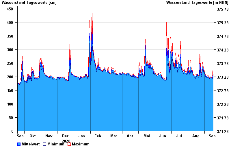
- Chamerau >
- Chart of year

Chart of year Chamerau / Regen
Waterlevel from 18.09.2020 to 17.09.2021
- 13.08.2002 Wasserstand: 680 cm
- 21.12.1993 Wasserstand: 600 cm
- 22.07.1980 Wasserstand: 575 cm
- 01.11.1998 Wasserstand: 555 cm
- 21.03.2002 Wasserstand: 543 cm
| Date | Mean value [cm] | Maximum [cm] | Minimum [cm] |
|---|---|---|---|
| 17.09.2021 | 209 | 220 | 203 |
| 16.09.2021 | 203 | 222 | 196 |
| 15.09.2021 | 193 | 197 | 189 |
| 14.09.2021 | 193 | 195 | 191 |
| 13.09.2021 | 196 | 199 | 194 |
| 12.09.2021 | 198 | 200 | 196 |
| 11.09.2021 | 196 | 200 | 193 |
© Bayerisches Landesamt für Umwelt 2024