
- Start >
- Rivers >
- Waterlevel >
- Untere Donau >
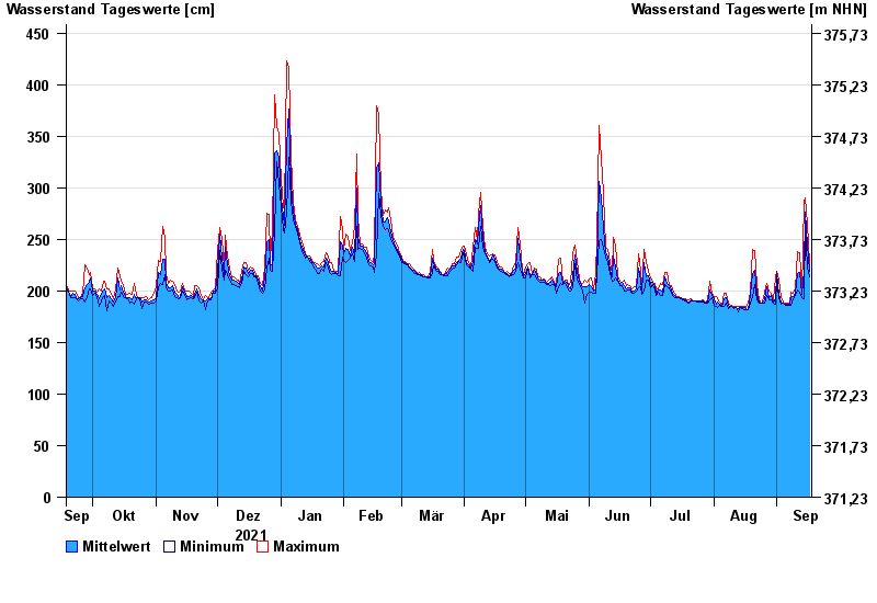
- Chamerau >
- Chart of year

Chart of year Chamerau / Regen
Waterlevel from 18.09.2021 to 17.09.2022
- 13.08.2002 Wasserstand: 680 cm
- 21.12.1993 Wasserstand: 600 cm
- 22.07.1980 Wasserstand: 575 cm
- 01.11.1998 Wasserstand: 555 cm
- 21.03.2002 Wasserstand: 543 cm
| Date | Mean value [cm] | Maximum [cm] | Minimum [cm] |
|---|---|---|---|
| 17.09.2022 | 219 | 226 | 214 |
| 16.09.2022 | 244 | 266 | 222 |
| 15.09.2022 | 276 | 290 | 266 |
| 14.09.2022 | 220 | 287 | 192 |
| 13.09.2022 | 197 | 199 | 193 |
| 12.09.2022 | 218 | 237 | 199 |
| 11.09.2022 | 217 | 238 | 201 |
© Bayerisches Landesamt für Umwelt 2024