
- Start >
- Rivers >
- Waterlevel >
- Untere Donau >
- Appolding >
- Chart of year

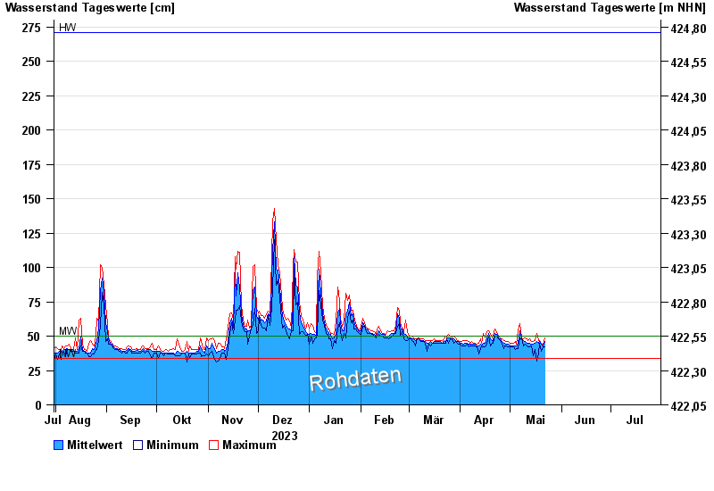
Chart of year Appolding / Strogen
Waterlevel from 31.07.2023 to 30.07.2024
| Date | Mean value [cm] | Maximum [cm] | Minimum [cm] |
|---|---|---|---|
| 09.06.2024 | 55 | 56 | 54 |
| 08.06.2024 | 54 | 63 | 50 |
| 07.06.2024 | 60 | 72 | 53 |
| 06.06.2024 | 61 | 77 | 58 |
| 05.06.2024 | 68 | 75 | 60 |
| 04.06.2024 | 92 | 111 | 75 |
| 03.06.2024 | 96 | 110 | 87 |
© Bayerisches Landesamt für Umwelt 2024