
- Start >
- Rivers >
- Waterlevel >
- Untere Donau >
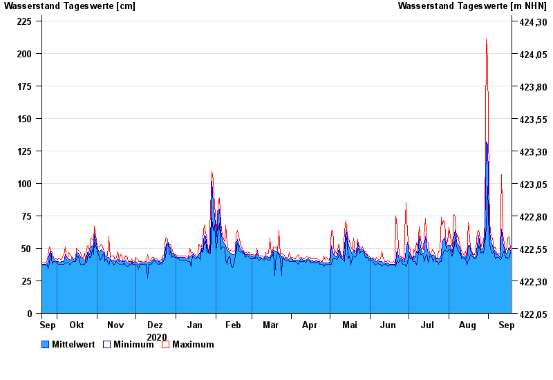
- Appolding >
- Chart of year

Chart of year Appolding / Strogen
Waterlevel from 19.09.2020 to 18.09.2021
- 03.06.2013 Wasserstand: 271 cm
- 02.08.1991 Wasserstand: 256 cm
- 15.02.1990 Wasserstand: 233 cm
- 14.04.1994 Wasserstand: 214 cm
- 18.06.1979 Wasserstand: 213 cm
| Date | Mean value [cm] | Maximum [cm] | Minimum [cm] |
|---|---|---|---|
| 18.09.2021 | 48 | 50 | 47 |
| 17.09.2021 | 51 | 59 | 43 |
| 16.09.2021 | 48 | 58 | 42 |
| 15.09.2021 | 46 | 51 | 43 |
| 14.09.2021 | 47 | 48 | 43 |
| 13.09.2021 | 50 | 54 | 48 |
| 12.09.2021 | 54 | 60 | 46 |
© Bayerisches Landesamt für Umwelt 2024