
- Start >
- Rivers >
- Waterlevel >
- Naab - Regen >
- Untereppenried >
- Chart of year

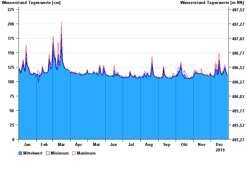
Chart of year Untereppenried / Ascha
Waterlevel from 01.01.2019 to 31.12.2019
- 26.01.1995 Wasserstand: 249 cm
- 21.12.1993 Wasserstand: 248 cm
- 05.12.1988 Wasserstand: 248 cm
- 12.08.2002 Wasserstand: 245 cm
- 26.02.1997 Wasserstand: 245 cm
| Date | Mean value [cm] | Maximum [cm] | Minimum [cm] |
|---|---|---|---|
| 31.12.2019 | 111 | 111 | 111 |
| 30.12.2019 | 111 | 112 | 111 |
| 29.12.2019 | 112 | 113 | 112 |
| 28.12.2019 | 114 | 116 | 112 |
| 27.12.2019 | 118 | 121 | 116 |
| 26.12.2019 | 124 | 128 | 121 |
| 25.12.2019 | 125 | 129 | 121 |
© Bayerisches Landesamt für Umwelt 2024