
- Start >
- Rivers >
- Waterlevel >
- Naab - Regen >
- Pfrentsch >
- Chart of year

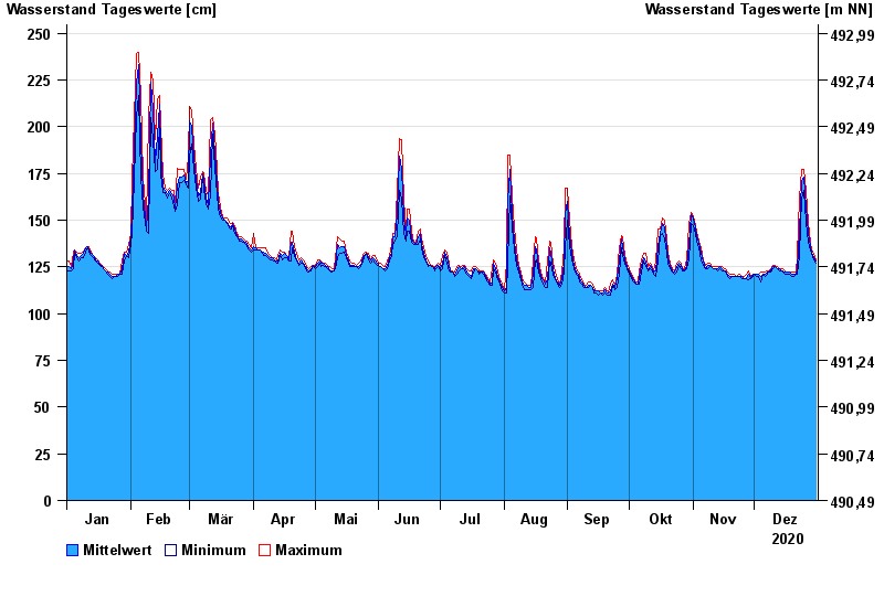
Chart of year Pfrentsch / Pfreimd
Waterlevel from 01.01.2020 to 31.12.2020
- 14.01.2011 Wasserstand: 311 cm
- 03.06.2013 Wasserstand: 310 cm
- 20.01.2012 Wasserstand: 283 cm
- 24.12.2012 Wasserstand: 273 cm
- 17.12.2011 Wasserstand: 256 cm
| Date | Mean value [cm] | Maximum [cm] | Minimum [cm] |
|---|---|---|---|
| 31.12.2020 | 128 | 129 | 127 |
| 30.12.2020 | 130 | 132 | 129 |
| 29.12.2020 | 133 | 134 | 132 |
| 28.12.2020 | 136 | 138 | 134 |
| 27.12.2020 | 143 | 149 | 138 |
| 26.12.2020 | 157 | 166 | 149 |
| 25.12.2020 | 173 | 177 | 166 |
© Bayerisches Landesamt für Umwelt 2024