
- Start >
- Rivers >
- Waterlevel >
- Naab - Regen >
- Pfrentsch >
- Chart of year

Chart of year Pfrentsch / Pfreimd
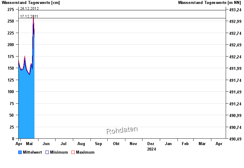
Waterlevel from 27.04.2024 to 26.04.2025
- 14.01.2011 Wasserstand: 311 cm
- 03.06.2013 Wasserstand: 310 cm
- 20.01.2012 Wasserstand: 283 cm
- 24.12.2012 Wasserstand: 273 cm
- 17.12.2011 Wasserstand: 256 cm
| Date | Mean value [cm] | Maximum [cm] | Minimum [cm] |
|---|---|---|---|
| 05.05.2024 | 147 | 147 | 146 |
| 04.05.2024 | 147 | 148 | 147 |
| 03.05.2024 | 148 | 149 | 146 |
| 02.05.2024 | 145 | 146 | 145 |
| 01.05.2024 | 147 | 148 | 145 |
| 30.04.2024 | 149 | 151 | 148 |
| 29.04.2024 | 153 | 155 | 151 |
© Bayerisches Landesamt für Umwelt 2024