
- Start >
- Rivers >
- Waterlevel >
- Naab - Regen >
- Gressenwöhr >
- Chart of year

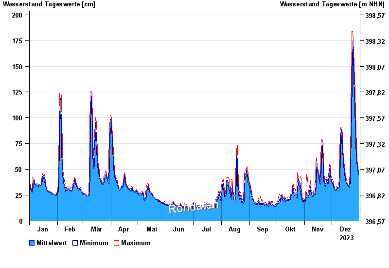
Chart of year Gressenwöhr / Vils
Waterlevel from 01.01.2023 to 31.12.2023
- 26.01.1995 Wasserstand: 275 cm
- 21.12.1993 Wasserstand: 261 cm
- 23.02.1970 Wasserstand: 260 cm
- 03.01.2003 Wasserstand: 254 cm
- 29.10.1998 Wasserstand: 242 cm
| Date | Mean value [cm] | Maximum [cm] | Minimum [cm] |
|---|---|---|---|
| 31.12.2023 | 45 | 47 | 44 |
| 30.12.2023 | 49 | 51 | 47 |
| 29.12.2023 | 55 | 59 | 51 |
| 28.12.2023 | 65 | 72 | 59 |
| 27.12.2023 | 89 | 107 | 73 |
| 26.12.2023 | 123 | 140 | 108 |
| 25.12.2023 | 152 | 164 | 140 |
© Bayerisches Landesamt für Umwelt 2024