
- Start >
- Rivers >
- Waterlevel >
- Obere Donau >
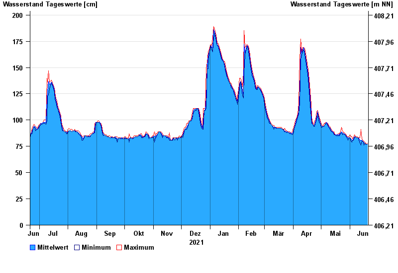
- Treuchtlingen >
- Chart of year

Chart of year Treuchtlingen / Altmühl
Waterlevel from 21.06.2021 to 20.06.2022
- 18.03.1988 Wasserstand: 349 cm
- 15.04.1994 Wasserstand: 338 cm
- 22.12.1993 Wasserstand: 336 cm
- 04.03.1987 Wasserstand: 325 cm
- 27.03.1988 Wasserstand: 315 cm
| Date | Mean value [cm] | Maximum [cm] | Minimum [cm] |
|---|---|---|---|
| 20.06.2022 | 77 | 78 | 77 |
| 19.06.2022 | 77 | 77 | 77 |
| 18.06.2022 | 77 | 78 | 77 |
| 17.06.2022 | 78 | 79 | 78 |
| 16.06.2022 | 79 | 80 | 76 |
| 15.06.2022 | 80 | 81 | 80 |
| 14.06.2022 | 81 | 82 | 80 |
© Bayerisches Landesamt für Umwelt 2024