
- Start >
- Rivers >
- Waterlevel >
- Obere Donau >
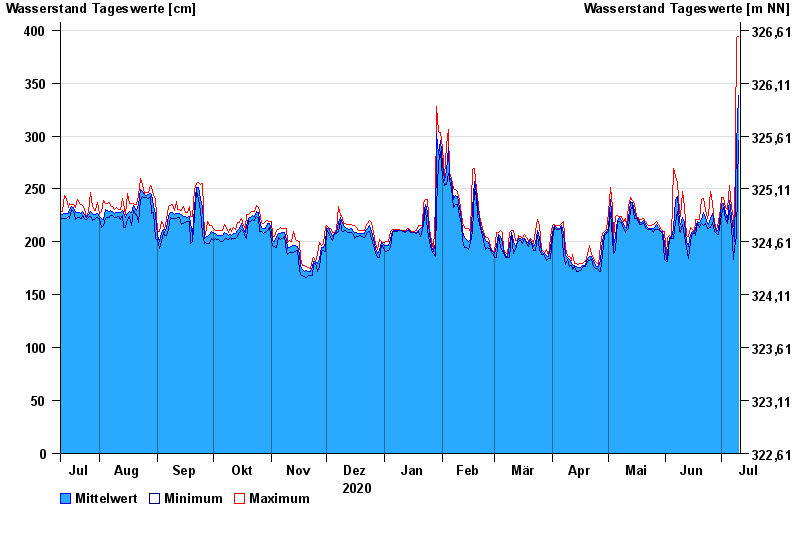
- Roth Kläranlage >
- Chart of year

Chart of year Roth Kläranlage / Rednitz
Waterlevel from 11.07.2020 to 10.07.2021
- 23.02.1970 Wasserstand: 484 cm
- 14.04.1994 Wasserstand: 479 cm
- 17.03.1988 Wasserstand: 479 cm
- 03.03.1987 Wasserstand: 474 cm
- 21.12.1993 Wasserstand: 473 cm
| Date | Mean value [cm] | Maximum [cm] | Minimum [cm] |
|---|---|---|---|
| 10.07.2021 | 338 | 394 | 296 |
| 09.07.2021 | 291 | 393 | 205 |
| 08.07.2021 | 200 | 205 | 195 |
| 07.07.2021 | 209 | 223 | 183 |
| 06.07.2021 | 225 | 232 | 214 |
| 05.07.2021 | 239 | 253 | 230 |
| 04.07.2021 | 221 | 231 | 217 |
© Bayerisches Landesamt für Umwelt 2024