
- Start >
- Rivers >
- Waterlevel >
- Obere Donau >
- Roth Kläranlage >
- Chart of year

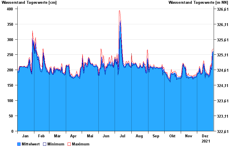
Chart of year Roth Kläranlage / Rednitz
Waterlevel from 01.01.2021 to 31.12.2021
- 23.02.1970 Wasserstand: 484 cm
- 14.04.1994 Wasserstand: 479 cm
- 17.03.1988 Wasserstand: 479 cm
- 03.03.1987 Wasserstand: 474 cm
- 21.12.1993 Wasserstand: 473 cm
| Date | Mean value [cm] | Maximum [cm] | Minimum [cm] |
|---|---|---|---|
| 31.12.2021 | 261 | 268 | 253 |
| 30.12.2021 | 259 | 267 | 251 |
| 29.12.2021 | 253 | 265 | 225 |
| 28.12.2021 | 207 | 225 | 200 |
| 27.12.2021 | 206 | 210 | 202 |
| 26.12.2021 | 213 | 217 | 207 |
| 25.12.2021 | 196 | 212 | 185 |
© Bayerisches Landesamt für Umwelt 2024