
- Start >
- Rivers >
- Waterlevel >
- Obere Donau >
- Neustadt >
- Chart of year

Chart of year Neustadt / Donau
Waterlevel from 20.01.2023 to 19.01.2024
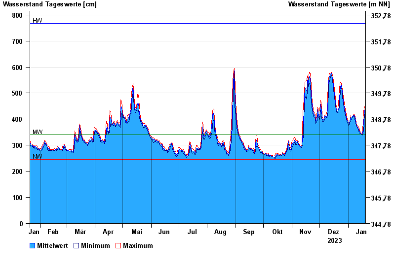
| Date | Mean value [cm] | Maximum [cm] | Minimum [cm] |
|---|---|---|---|
| 19.01.2024 | 435 | 448 | 420 |
| 18.01.2024 | 388 | 431 | 354 |
| 17.01.2024 | 343 | 354 | 340 |
| 16.01.2024 | 343 | 346 | 339 |
| 15.01.2024 | 344 | 347 | 342 |
| 14.01.2024 | 348 | 350 | 345 |
| 13.01.2024 | 357 | 364 | 348 |
© Bayerisches Landesamt für Umwelt 2024