
- Start >
- Rivers >
- Waterlevel >
- Obere Donau >
- Neustadt >
- Chart of year

Chart of year Neustadt / Donau
Waterlevel from 20.01.2022 to 19.01.2023
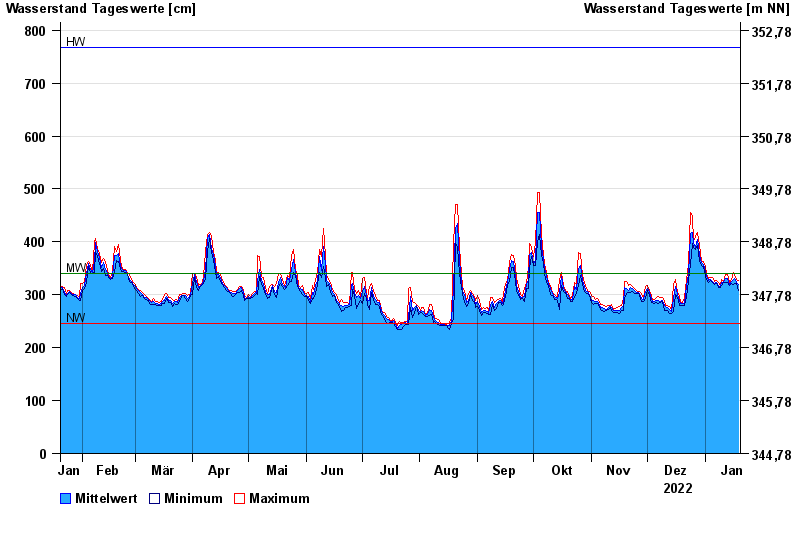
| Date | Mean value [cm] | Maximum [cm] | Minimum [cm] |
|---|---|---|---|
| 19.01.2023 | 319 | 327 | 309 |
| 18.01.2023 | 323 | 328 | 321 |
| 17.01.2023 | 330 | 336 | 322 |
| 16.01.2023 | 329 | 343 | 320 |
| 15.01.2023 | 326 | 329 | 322 |
| 14.01.2023 | 320 | 324 | 317 |
| 13.01.2023 | 330 | 339 | 323 |
© Bayerisches Landesamt für Umwelt 2024