
- Start >
- Rivers >
- Waterlevel >
- Obere Donau >
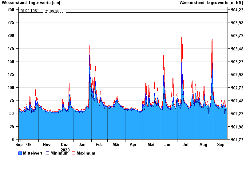
- Nattenhausen >
- Chart of year

Chart of year Nattenhausen / Günz
Waterlevel from 27.09.2020 to 26.09.2021
- 12.08.2002 Wasserstand: 265 cm
- 18.06.1991 Wasserstand: 259 cm
- 10.06.2013 Wasserstand: 255 cm
- 29.09.1981 Wasserstand: 244 cm
- 21.09.2000 Wasserstand: 243 cm
| Date | Mean value [cm] | Maximum [cm] | Minimum [cm] |
|---|---|---|---|
| 26.09.2021 | 60 | 63 | 58 |
| 25.09.2021 | 60 | 62 | 58 |
| 24.09.2021 | 61 | 62 | 56 |
| 23.09.2021 | 61 | 63 | 58 |
| 22.09.2021 | 61 | 78 | 45 |
| 21.09.2021 | 65 | 69 | 58 |
| 20.09.2021 | 67 | 72 | 60 |
© Bayerisches Landesamt für Umwelt 2024