
- Start >
- Rivers >
- Waterlevel >
- Obere Donau >
- Nattenhausen >
- Chart of month

Chart of month Nattenhausen / Günz
Waterlevel from 23.06.2021 to 22.07.2021
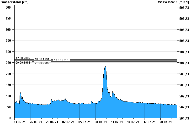
- 12.08.2002 Wasserstand: 265 cm
- 18.06.1991 Wasserstand: 259 cm
- 10.06.2013 Wasserstand: 255 cm
- 29.09.1981 Wasserstand: 244 cm
- 21.09.2000 Wasserstand: 243 cm
| Date | Waterlevel [cm] |
|---|---|
| 23.07.2021 00:45 | 60 |
| 23.07.2021 00:30 | 60 |
| 23.07.2021 00:15 | 60 |
| 23.07.2021 00:00 | 60 |
| 22.07.2021 23:45 | 59 |
| 22.07.2021 23:30 | 59 |
| 22.07.2021 23:15 | 59 |
© Bayerisches Landesamt für Umwelt 2024