
- Start >
- Rivers >
- Waterlevel >
- Obere Donau >
- Mühlstetten >
- Chart of total period

Chart of total period Mühlstetten / Schwäbische Rezat
Waterlevel from 06.09.1965 to 26.04.2024
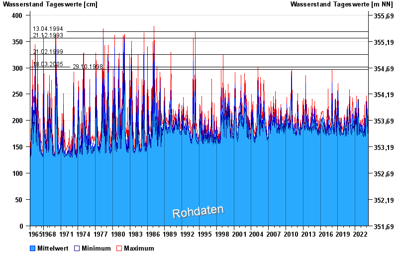
- 13.04.1994 Wasserstand: 369 cm
- 21.12.1993 Wasserstand: 356 cm
- 21.02.1999 Wasserstand: 325 cm
- 18.03.2005 Wasserstand: 301 cm
- 29.10.1998 Wasserstand: 297 cm
| Date | Mean value [cm] | Maximum [cm] | Minimum [cm] |
|---|---|---|---|
| 26.04.2024 | 171 | 172 | 167 |
| 25.04.2024 | 171 | 171 | 171 |
| 24.04.2024 | 172 | 172 | 171 |
| 23.04.2024 | 172 | 174 | 170 |
| 22.04.2024 | 174 | 179 | 171 |
| 21.04.2024 | 175 | 179 | 171 |
| 20.04.2024 | 175 | 181 | 173 |
© Bayerisches Landesamt für Umwelt 2024