
- Start >
- Rivers >
- Waterlevel >
- Obere Donau >
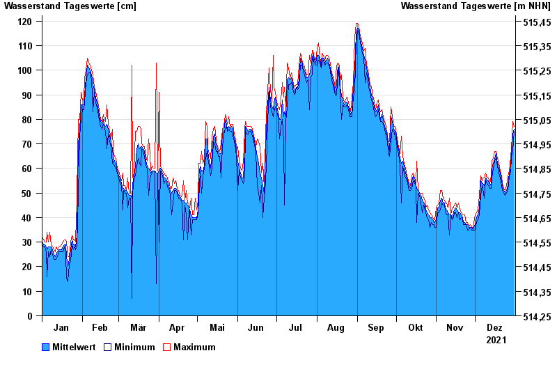
- Fürstenfeldbruck >
- Chart of year

Chart of year Fürstenfeldbruck / Amper
Waterlevel from 01.01.2021 to 31.12.2021
- 03.06.1940 Wasserstand: 257 cm
- 24.05.1999 Wasserstand: 254 cm
- 12.06.1965 Wasserstand: 253 cm
- 13.07.1954 Wasserstand: 223 cm
- 18.06.1910 Wasserstand: 212 cm
| Date | Mean value [cm] | Maximum [cm] | Minimum [cm] |
|---|---|---|---|
| 31.12.2021 | 76 | 77 | 75 |
| 30.12.2021 | 74 | 79 | 67 |
| 29.12.2021 | 67 | 68 | 65 |
| 28.12.2021 | 60 | 65 | 58 |
| 27.12.2021 | 58 | 59 | 57 |
| 26.12.2021 | 53 | 57 | 51 |
| 25.12.2021 | 51 | 53 | 50 |
© Bayerisches Landesamt für Umwelt 2024