
- Start >
- Rivers >
- Waterlevel >
- Obere Donau >
- Appolding >
- Chart of year

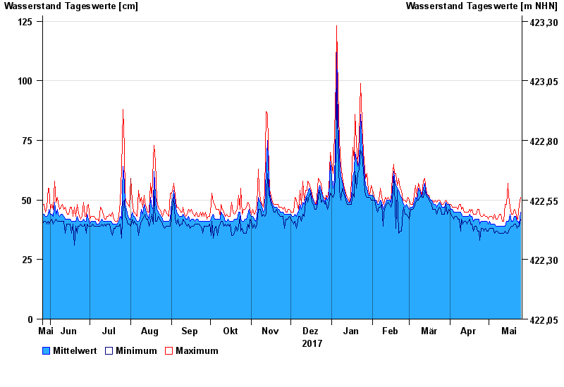
Chart of year Appolding / Strogen
Waterlevel from 26.05.2017 to 25.05.2018
- 09.06.1965 Wasserstand: 308 cm
- 01.06.1965 Wasserstand: 286 cm
- 03.06.2013 Wasserstand: 271 cm
- 02.08.1991 Wasserstand: 256 cm
- 15.02.1990 Wasserstand: 233 cm
| Date | Mean value [cm] | Maximum [cm] | Minimum [cm] |
|---|---|---|---|
| 25.05.2018 | 45 | 51 | 42 |
| 24.05.2018 | 40 | 48 | 39 |
| 23.05.2018 | 41 | 42 | 39 |
| 22.05.2018 | 41 | 42 | 38 |
| 21.05.2018 | 43 | 45 | 40 |
| 20.05.2018 | 43 | 46 | 40 |
| 19.05.2018 | 41 | 44 | 39 |
© Bayerisches Landesamt für Umwelt 2024