
- Start >
- Rivers >
- Waterlevel >
- Iller - Lech - Bodensee >
- Waldstetten >
- Chart of month

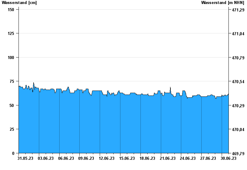
Chart of month Waldstetten / Günz
Waterlevel from 31.05.2023 to 30.06.2023
- 12.08.2002 Wasserstand: 279 cm
- 11.06.2013 Wasserstand: 270 cm
- 19.06.1991 Wasserstand: 265 cm
- 22.09.2000 Wasserstand: 256 cm
- 30.05.2007 Wasserstand: 255 cm
| Date | Waterlevel [cm] |
|---|---|
| 01.07.2023 00:45 | 65 |
| 01.07.2023 00:30 | 65 |
| 01.07.2023 00:15 | 65 |
| 01.07.2023 00:00 | 65 |
| 30.06.2023 23:45 | 63 |
| 30.06.2023 23:30 | 62 |
| 30.06.2023 23:15 | 61 |
© Bayerisches Landesamt für Umwelt 2024