
- Start >
- Rivers >
- Waterlevel >
- Iller - Lech - Bodensee >
- Waldstetten >
- Chart of month

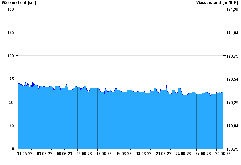
Chart of month Waldstetten / Günz
Waterlevel from 31.05.2023 to 30.06.2023
 Für diesen Pegel sind keine Hochwassermarken hinterlegt.
| Date | Waterlevel [cm] |
|---|---|
| 01.07.2023 00:45 | 65 |
| 01.07.2023 00:30 | 65 |
| 01.07.2023 00:15 | 65 |
| 01.07.2023 00:00 | 65 |
| 30.06.2023 23:45 | 63 |
| 30.06.2023 23:30 | 62 |
| 30.06.2023 23:15 | 61 |
© Bayerisches Landesamt für Umwelt 2024