
- Start >
- Rivers >
- Waterlevel >
- Oberer Main - Elbe >
- Schwürbitz >
- Chart of year

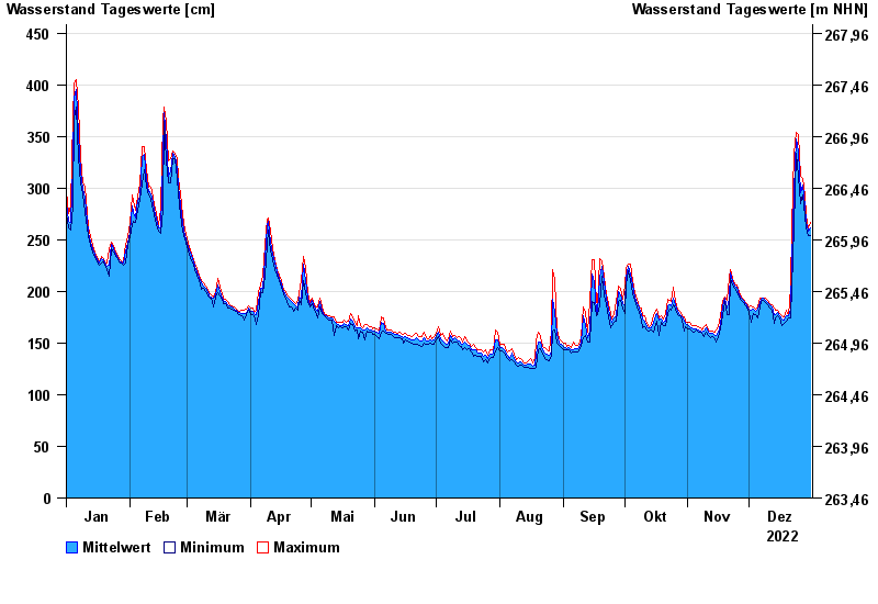
Chart of year Schwürbitz / Main
Waterlevel from 01.01.2022 to 31.12.2022
- 24.12.1967 Wasserstand: 591 cm
- 28.01.2002 Wasserstand: 556 cm
- 03.01.2003 Wasserstand: 553 cm
- 06.01.1982 Wasserstand: 546 cm
- 14.01.2011 Wasserstand: 544 cm
| Date | Mean value [cm] | Maximum [cm] | Minimum [cm] |
|---|---|---|---|
| 31.12.2022 | 262 | 267 | 254 |
| 30.12.2022 | 258 | 261 | 254 |
| 29.12.2022 | 267 | 273 | 261 |
| 28.12.2022 | 282 | 293 | 273 |
| 27.12.2022 | 303 | 309 | 293 |
| 26.12.2022 | 296 | 312 | 285 |
| 25.12.2022 | 336 | 352 | 312 |
© Bayerisches Landesamt für Umwelt 2024