
- Start >
- Rivers >
- Waterlevel >
- Oberer Main - Elbe >
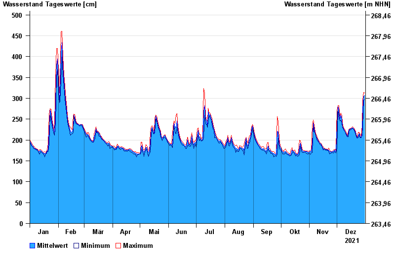
- Schwürbitz >
- Chart of year

Chart of year Schwürbitz / Main
Waterlevel from 01.01.2021 to 31.12.2021
- 24.12.1967 Wasserstand: 591 cm
- 28.01.2002 Wasserstand: 556 cm
- 03.01.2003 Wasserstand: 553 cm
- 06.01.1982 Wasserstand: 546 cm
- 14.01.2011 Wasserstand: 544 cm
| Date | Mean value [cm] | Maximum [cm] | Minimum [cm] |
|---|---|---|---|
| 31.12.2021 | 307 | 313 | 297 |
| 30.12.2021 | 305 | 314 | 295 |
| 29.12.2021 | 274 | 295 | 235 |
| 28.12.2021 | 218 | 235 | 210 |
| 27.12.2021 | 206 | 210 | 205 |
| 26.12.2021 | 209 | 213 | 206 |
| 25.12.2021 | 216 | 218 | 213 |
© Bayerisches Landesamt für Umwelt 2024