
- Start >
- Rivers >
- Waterlevel >
- Oberer Main - Elbe >
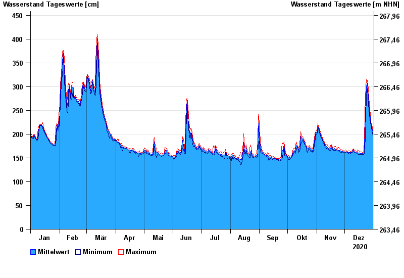
- Schwürbitz >
- Chart of year

Chart of year Schwürbitz / Main
Waterlevel from 01.01.2020 to 31.12.2020
- 24.12.1967 Wasserstand: 591 cm
- 28.01.2002 Wasserstand: 556 cm
- 03.01.2003 Wasserstand: 553 cm
- 06.01.1982 Wasserstand: 546 cm
- 14.01.2011 Wasserstand: 544 cm
| Date | Mean value [cm] | Maximum [cm] | Minimum [cm] |
|---|---|---|---|
| 31.12.2020 | 203 | 207 | 197 |
| 30.12.2020 | 214 | 219 | 207 |
| 29.12.2020 | 223 | 225 | 219 |
| 28.12.2020 | 233 | 240 | 224 |
| 27.12.2020 | 250 | 263 | 240 |
| 26.12.2020 | 279 | 296 | 263 |
| 25.12.2020 | 307 | 314 | 296 |
© Bayerisches Landesamt für Umwelt 2024