
- Start >
- Rivers >
- Waterlevel >
- Oberer Main - Elbe >
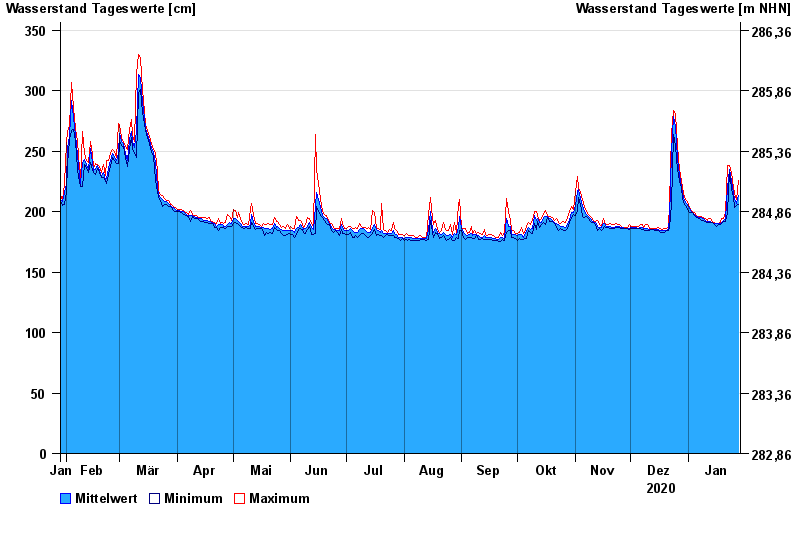
- Coburg >
- Chart of year

Chart of year Coburg / Itz
Waterlevel from 29.01.2020 to 28.01.2021
- 06.01.1982 Wasserstand: 514 cm
- 10.03.1981 Wasserstand: 510 cm
- 03.01.2003 Wasserstand: 496 cm
- 07.02.1984 Wasserstand: 459 cm
- 02.01.1987 Wasserstand: 454 cm
| Date | Mean value [cm] | Maximum [cm] | Minimum [cm] |
|---|---|---|---|
| 28.01.2021 | 213 | 226 | 206 |
| 27.01.2021 | 207 | 210 | 205 |
| 26.01.2021 | 211 | 215 | 203 |
| 25.01.2021 | 215 | 220 | 212 |
| 24.01.2021 | 226 | 232 | 219 |
| 23.01.2021 | 235 | 238 | 232 |
| 22.01.2021 | 220 | 238 | 199 |
© Bayerisches Landesamt für Umwelt 2024