
- Start >
- Rivers >
- Waterlevel >
- Oberer Main - Elbe >
- Coburg >
- Chart of month

Chart of month Coburg / Itz
Waterlevel from 01.07.2021 to 31.07.2021
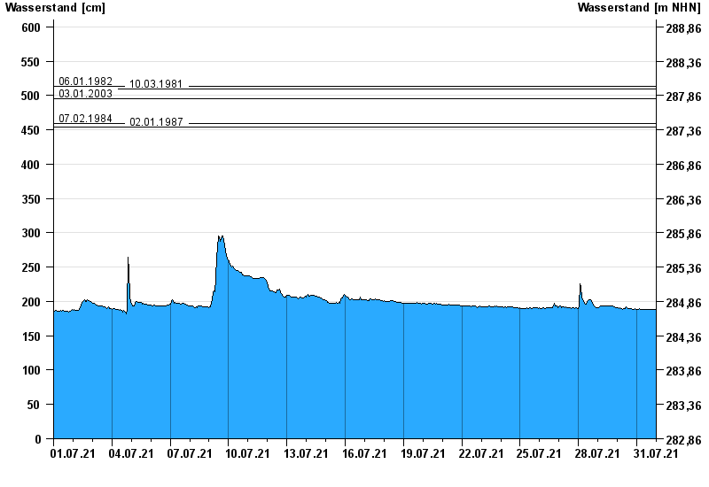
- 06.01.1982 Wasserstand: 514 cm
- 10.03.1981 Wasserstand: 510 cm
- 03.01.2003 Wasserstand: 496 cm
- 07.02.1984 Wasserstand: 459 cm
- 02.01.1987 Wasserstand: 454 cm
| Date | Waterlevel [cm] |
|---|---|
| 01.08.2021 00:45 | 188 |
| 01.08.2021 00:30 | 188 |
| 01.08.2021 00:15 | 188 |
| 01.08.2021 00:00 | 188 |
| 31.07.2021 23:45 | 188 |
| 31.07.2021 23:30 | 189 |
| 31.07.2021 23:15 | 188 |
© Bayerisches Landesamt für Umwelt 2024