
- Start >
- Rivers >
- Waterlevel >
- Bayern >
- Würzburg >
- Master data

Master data Würzburg
Site number: 24042000
Community: Würzburg
District: Würzburg
Operator:  Wasserstraßen- und Schifffahrtsamt Main
Body of water: Main
Catchment: 14018.30 km2
River chainage: 251.97 km
Easting: 566632 (ETRS89 / UTM Zone 32N)
Northing: 5516370
Gauge zero point: 164.51 m NHN (DHHN2016)
Picture of the measurement site
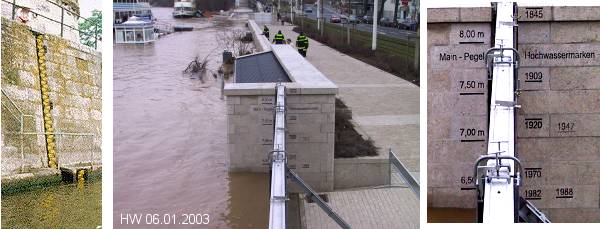
Location of the station Würzburg / Main
| Measurement site | Category |
|---|---|
 Würzburg Würzburg | Rivers: Runoff, Waterlevel, Water temperature, Water temperature |
| Würzburg Q | Rivers: Runoff |
| Marktbreit | Rivers: Runoff, Waterlevel |
| Würzburg | Rivers: Runoff, Waterlevel |
© Bayerisches Landesamt für Umwelt 2026