
- Start >
- Rivers >
- Waterlevel >
- Bayern >
- Wolnzach >
- Chart of year

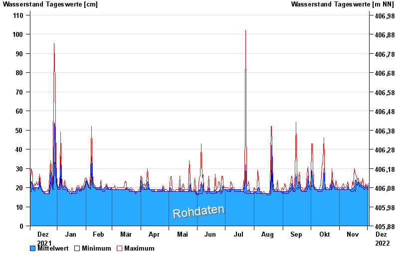
Chart of year Wolnzach / Wolnzach
Waterlevel from 03.12.2021 to 02.12.2022
Hinweis:
Der Wasserstand am Pegel wird durch Geschiebe nach Hochwasser beeinflusst.
| Date | Mean value [cm] | Maximum [cm] | Minimum [cm] |
|---|---|---|---|
| 02.12.2022 | 21 | 22 | 19 |
| 01.12.2022 | 19 | 20 | 19 |
| 30.11.2022 | 20 | 21 | 20 |
| 29.11.2022 | 21 | 22 | 20 |
| 28.11.2022 | 20 | 20 | 19 |
| 27.11.2022 | 20 | 20 | 19 |
| 26.11.2022 | 21 | 25 | 20 |
© Bayerisches Landesamt für Umwelt 2025